|
<< Click to Display Table of Contents >> Setting up Layers |
  
|
|
<< Click to Display Table of Contents >> Setting up Layers |
  
|
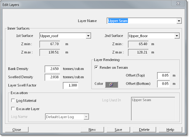
Strata such as coal seams and waste are represented in 3d-DigPlus as layers. A layer is a solid bounded by two inner surfaces. Once a layer is created it can be rendered on the topography and shown on cross sections. When an excavation is conducted, all material associated with the layers can be logged. To open the Edit Layers dialog box and change layer settings, select the Terrain/Surfaces/Layers menu option.

Edit Layers Dialog.
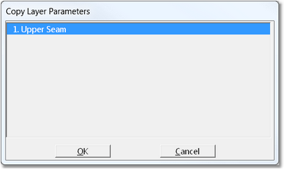
New layers are created by clicking the New button. This will display the Copy Layer Parameters dialog box:

Copy Layer Parameters Dialog.
A new layer is created by copying parameters from an existing layer. If no layer currently exists with the required parameters, click on any layer and manually input the correct properties after it is created.
To set the layer name, use the Layer Name field at the top of the dialog box. The vertical bounds of the layer are defined by setting the 1-st Inner Surface and the 2-nd Inner Surface. Use the two pull-down lists at the top of the dialog box to do this.
If you wish to render the layer on the topography, check the Render on Terrain check box. Click on the Layer Color button to set the layer base color. the Layer Rendering group includes two parameters Offset Top and Offset Bottom. These offsets respectively add a distance to the top and bottom of the layer. This is for layout rendering purposes only, it has no effect on excavation or volumetrics. In various situations when a layer is exposed the coloured rendering can be incomplete and patchy. The same applies when excavation proceeds to the floor of a layer. These offsets allow this problem to be corrected.
At the bottom left of the Layer Log dialog are the Material Properties and Excavation groups. Material associated with a given Layer can optionally be logged with 3d-DigPlus' Material Logging database. If the Log Material checkbox is selected a specialised Material Log for the layer will be created, and when material from this layer is excavated it will report to the appropriate Layer Log. The properties of the material for this Layer are set with the parameters in the Material Properties group. Note that Layer Logging was introduced in an early version of 3d-DigPlus and is now largely superseded by options available in Automated Excavation and Dump sequencing.